
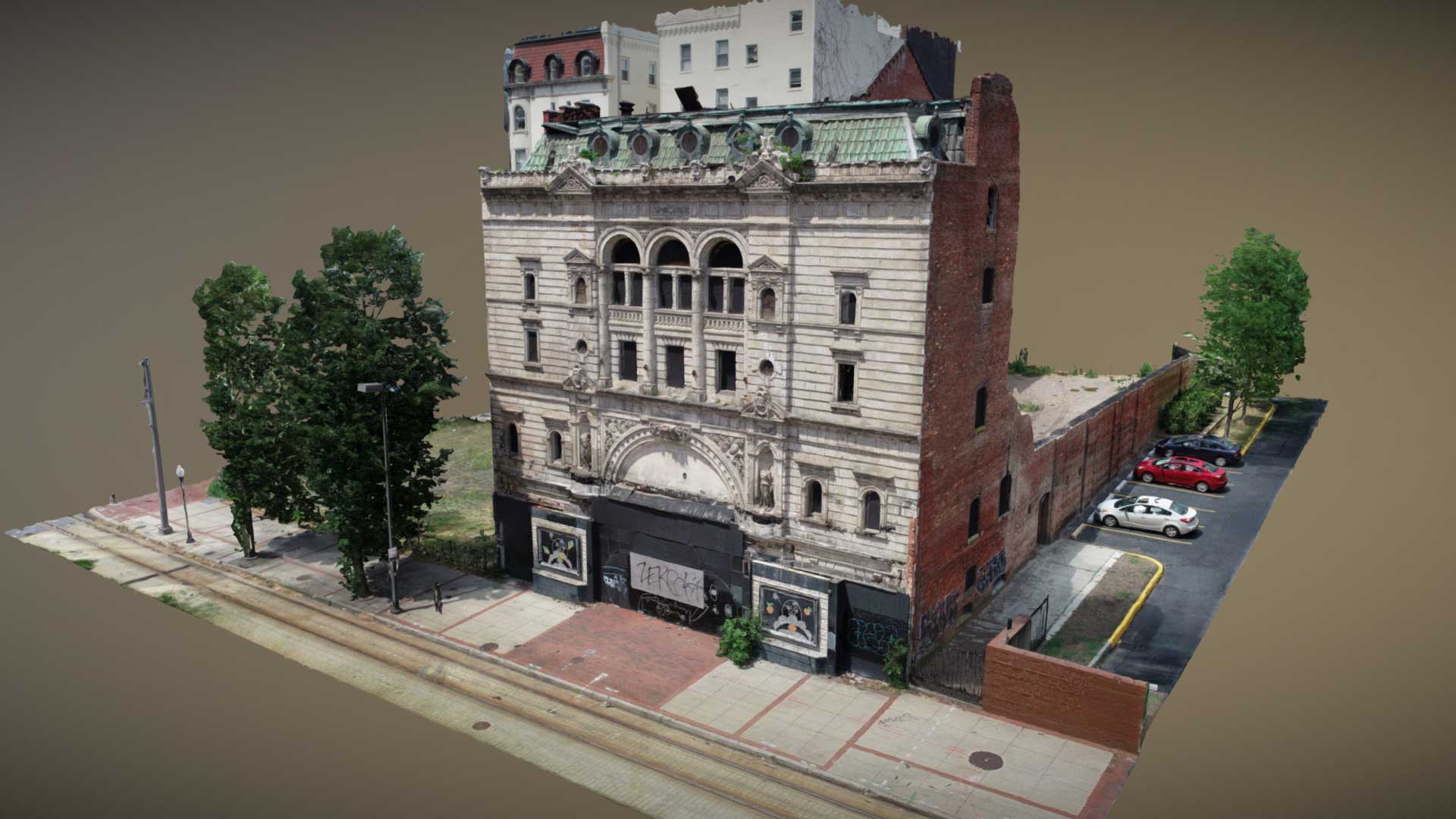
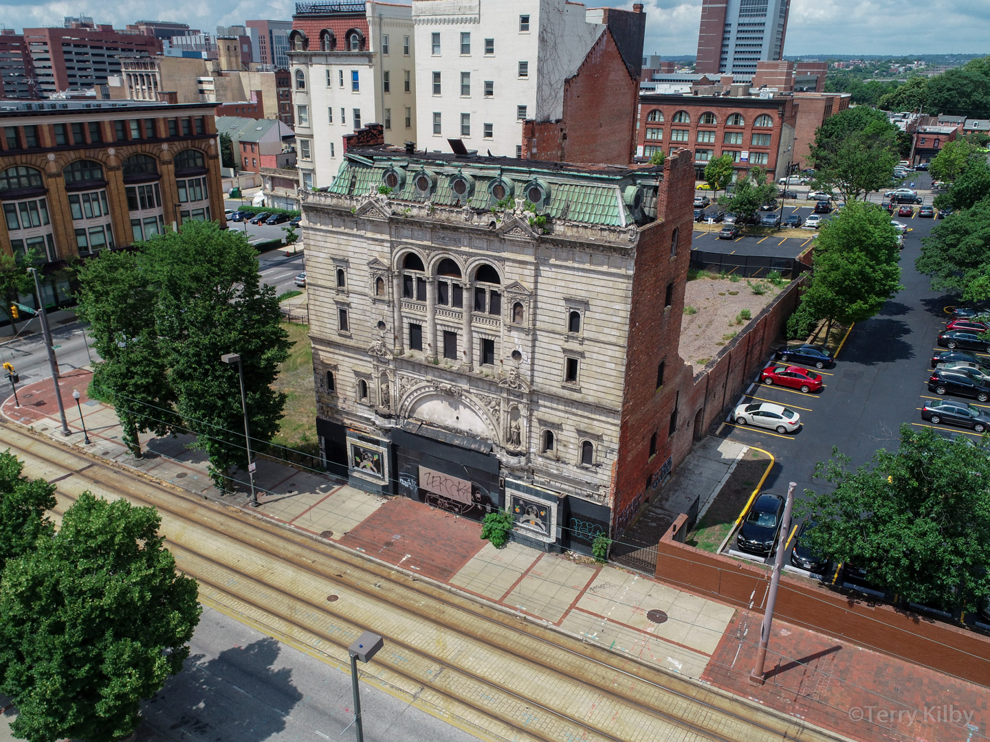
Site Scanning
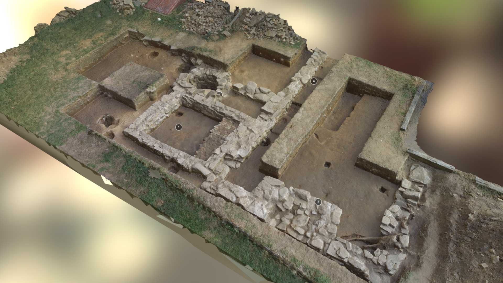
Site Scans capture an entire job site or structure in 3D and 2D through the use of photogrammetry. This is achieved by photographing the location hundreds or even thousands of times from all possible perspectives, and then processing that data set with special software that reconstructs the site in full 3D. Once processed in 3D, there are many deliverable types that can be produced from that data including 3D Point Clouds for CAD software, 2D Orthomosaics for GIS software, textured 3D assets for web or VR/AR display or even physical 3D prints. Multiple sites scans can be grouped together to provide a full 3D or 2D orthomosaic progression view of a site. If you are already scanning your site with the use of terrestrial LiDAR, photogrammetry data can be added to that dataset and provide a much larger coverage area and increased line of sight.
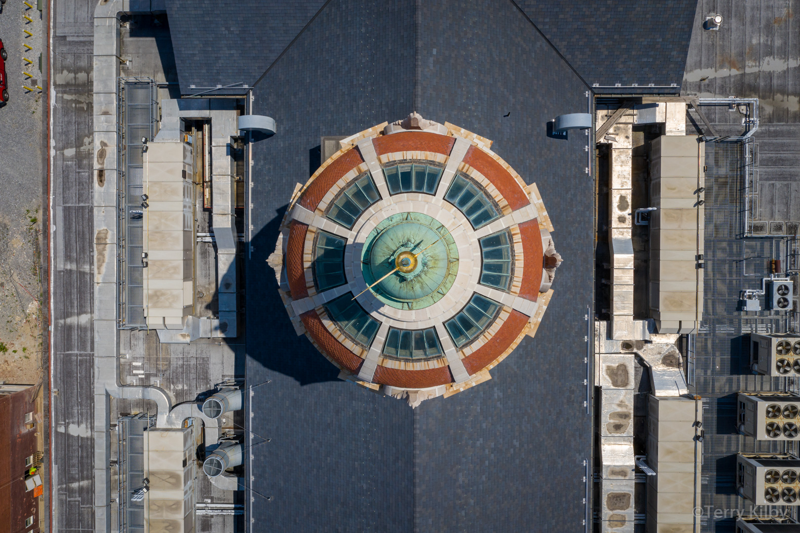
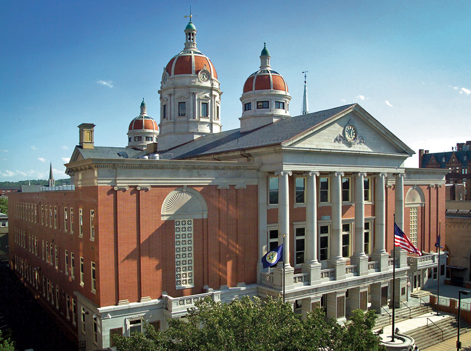
Examples
Compare 3D reconstructions to original source photos
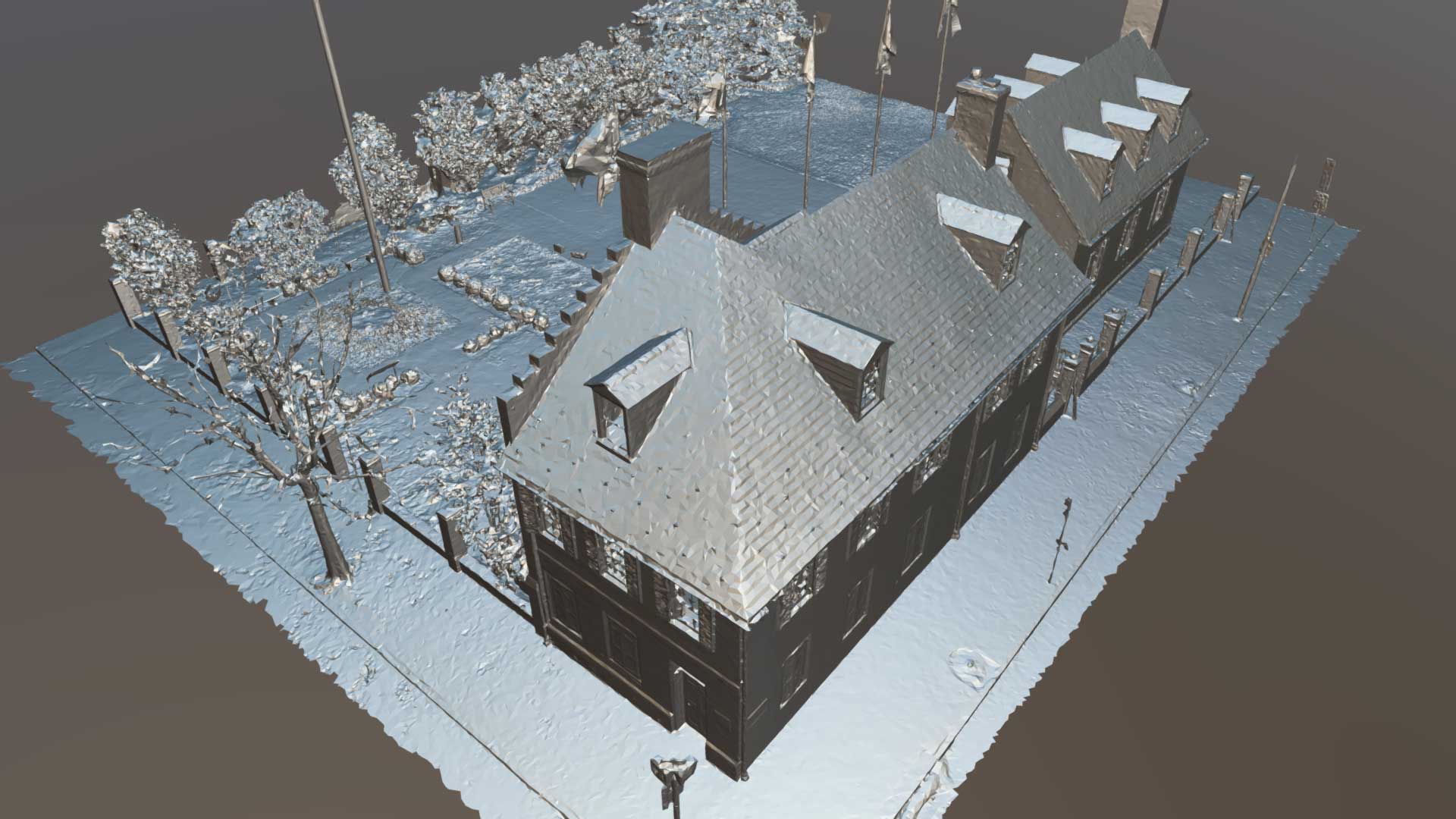
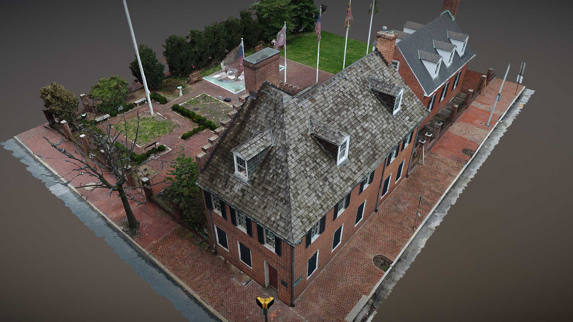

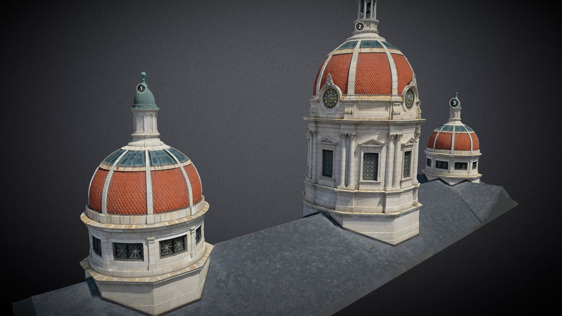

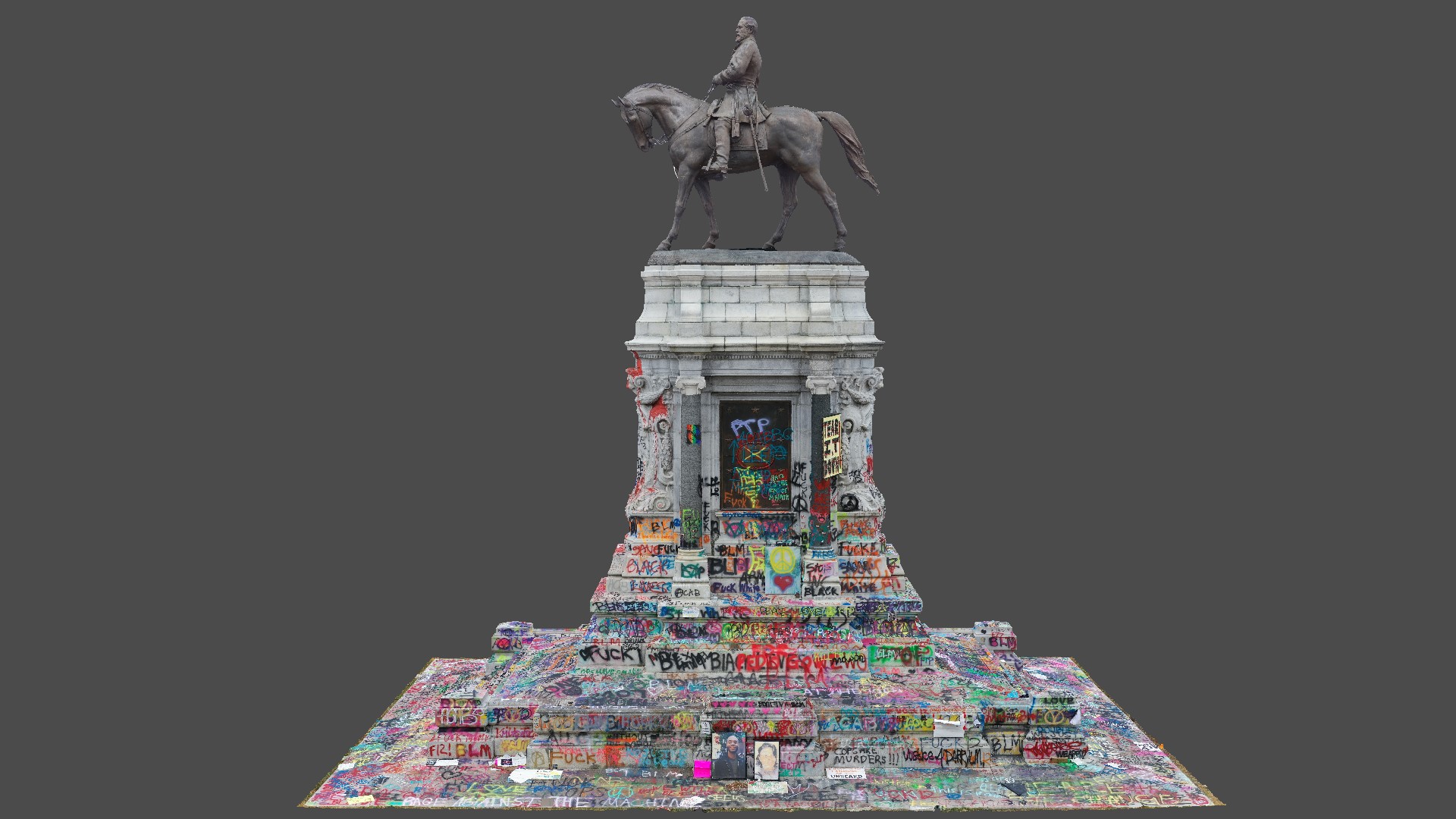
3D Models
Interactive models you can navigate freely or take the guided tour